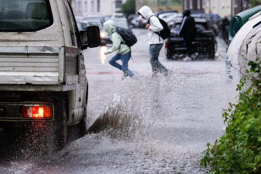
If you're braving the outdoors in Germany in the coming days, don't forget to bring a raincoat.
That's because you might come face-to-face with storms, torrential rain and hailstones.
The German Weather Service (DWD) warned on Tuesday of a "risk of severe weather in central Germany" this week, including "heavy rain and thunderstorms".
Temperatures have also dropped significantly in some parts of the country compared to previous days. In central areas, temperatures hovered around 11C on Wednesday. Further north in Bremen and Hamburg, the mercury dropped to 9C and even 7C in Hanover.
It's no wonder German newspaper Bild ran with the tagline: "Bye-bye Mini-Sommer."
Meteorologist Dominik Jung told Bild: "A virtually stationary low-pressure system is sitting over Central Europe, pushing in moist, unstable air. On the back side, significantly cooler air is flowing in from the north to north-east."
A mixed picture
The weather outlook from Wednesday depends on where you are in Germany.
Jung said there is a "risk of hailstones" in central areas.
"It’s going to get really unpleasant in central Germany: variable cloud cover, with heavy showers and, in places, severe thunderstorms with gusts of up to 70 kilometres per hour expected as the day progresses," he said.
"Temperatures will range from 11 to 18C."
READ ALSO: 'Third winter' begins - Germany's 11-season calendar explained
The south (Baden-Württemberg and Bavaria) had a better start with temperatures of 17 to 21C, but from midday onwards, thunderstorms are expected to hit that region – most intensely in the Bavarian Forest and on the edge of the Alps.
Hail is also possible, with gusts of up to 90 kilometres per hour forecast.
Risk of flash floods
Heavy rain is expected and could cause flash floods. Forecasters said the regions between the Eifel and the Ore Mountains were at risk.
Jung said, “We expect 20 to 25 litres per square metre in a short space of time. Over several hours, amounts of around 30 to 40 litres per square metre are possible.”
Climatologist Dr Karsten Brandt said Thuringia and Saxony would see the worst rainfall.
"It will be very wet there, with 100 litres of rain per square metre falling in some regions," he said. "There is a risk of severe weather."
In the far north (Schleswig-Holstein, the North Sea coast and parts of Mecklenburg-Western Pomerania), showers are forecast but the main issue there is cold conditions. The rest of the north (Lower Saxony, Hamburg, Bremen and eastern Mecklenburg-Western Pomerania) will be cloudy with prolonged rain.
It comes after a sizzling long weekend to mark the start of May. Highs of of 29.4C were recorded in Cottbus and Senftenberg near Berlin. And even Berlin's Marzahn district recorded temperatures just above 29C.
The good news is the bad weather will ease off, with warmer conditions set to return to Germany this weekend.
On Saturday Berlin is set to see highs of 18C and even 22C on Sunday. It's a similar picture in Munich and Cologne, although there may still be some showers.
Comments